Antique Atlas 4
Discover a completely new approach to navigation in Minecraft with Antique Atlas 4! This client-side world map features a unique hand-drawn style and offers numerous useful functions for explorers.
Main Features
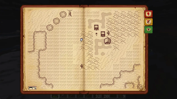
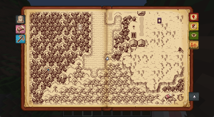
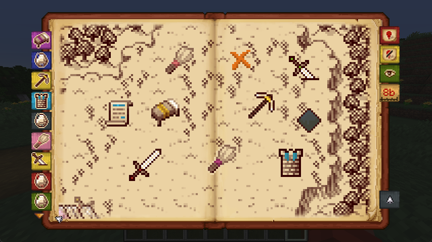
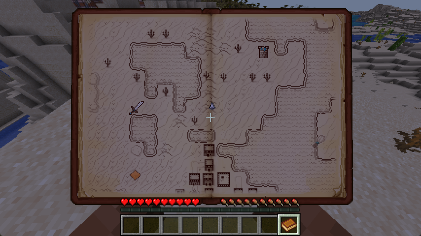
Press the M key at any time during gameplay to open a stylized world map. The controls are intuitive: drag to move around the map, use the mouse wheel to zoom, and create markers using special buttons.
Important feature: AA4 has absolutely no items! This means the map is available immediately after installation, cannot be lost, and works on any server without additional requirements.
Singleplayer Functions
The map is designed so you can focus on exploring the world, not constantly studying the map:
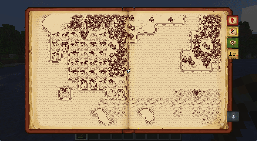
- Terrain is displayed using hand-drawn "tiles" that represent biomes and structures
- Each tile covers at least one chunk - no peeking at caves or bases!
- Gravestones automatically appear at your death location with customizable texts

- Various marker styles are available for points of interest
- Books renamed to "Antique Atlas" show your immediate surroundings as a minimap
Multiplayer Functions
These features work in singleplayer or on servers with Surveyor installed.
- Automatic addition of markers for significant structures and active Nether portals
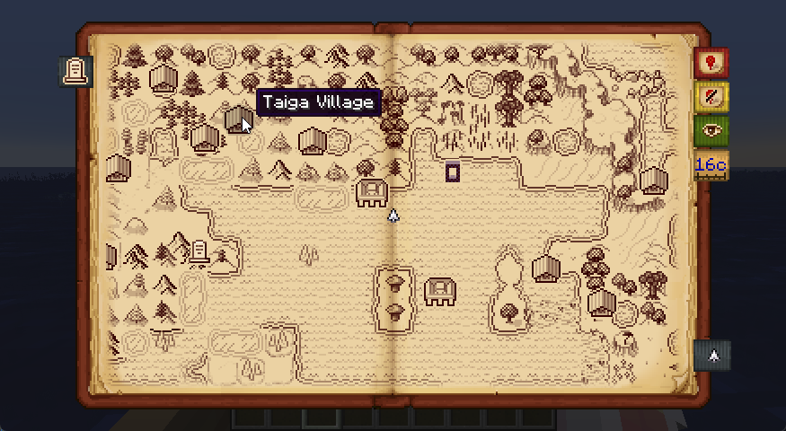
- Structures appear on the map only after you've examined them or stood on them in the game
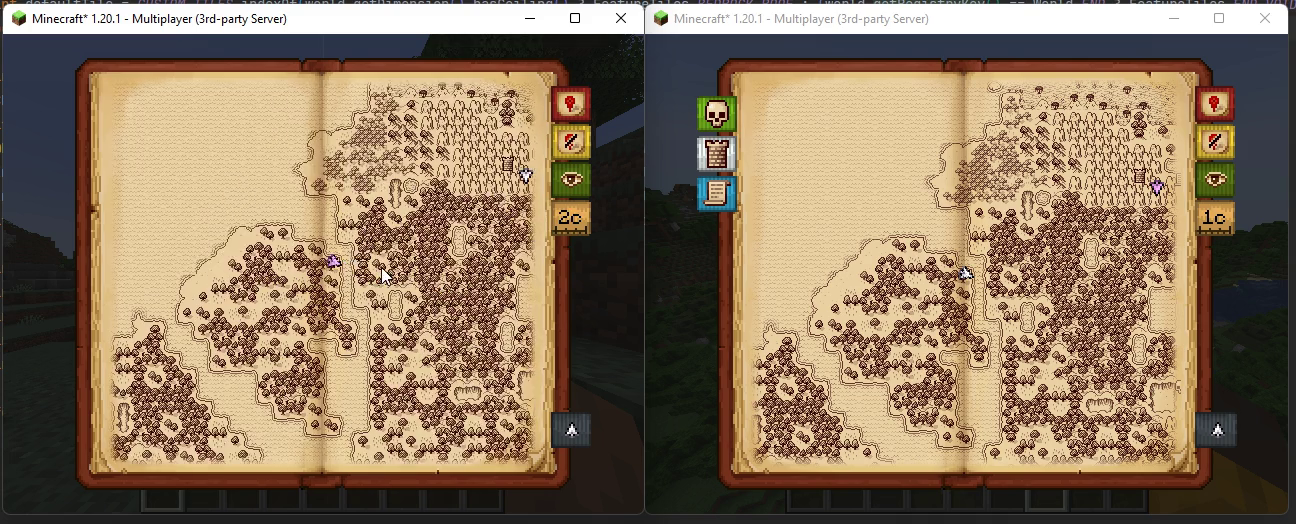
- Ability to share explored maps with other players using the
/surveyor share [player]command, which also shows those players' locations
Configuration
Antique Atlas is configured through the config/antique-atlas.toml file:
fullscreen - can be disabled for fixed map screen size based on GUI scale
mapScale - adjusts the effective scale of tiles on the map
structureMarkers - enables/disables markers for structures (populated during gameplay)
graveStyle - changes the icon and tooltip for player graves
Surveyor, which manages map sharing and visibility functions, is configured through config/surveyor.toml.
Resource Packs
Tiles, markers, biome detection, and structure detection are fully data-driven via resource packs. Without defined biomes, the atlas "guesses" tiles via tags and shows ??? if that fails.
For automatically marking points of interest that aren't structures, use Surveyor's Landmark API.
Technical Requirements
Requires Surveyor Map Framework. On (neo)forge requires Connector and Forgified Fabric API.
This is a fourth-generation rewrite of the original Antique Atlas by Hunternif, now using the modern Surveyor framework for enhanced functionality and compatibility.
Project members
sisby-folk
Developer

lumiscosity
Developer

exaptations
Developer
Created: 8 Jan 2024
ID: 1165